
Scientists studying minuscule seismic tremors along the Northern California coast have unearthed a more intricate and potentially hazardous geological reality than previously understood, offering critical new perspectives on the region’s seismic potential. This zone, a nexus where the colossal San Andreas fault system intersects with the formidable Cascadia subduction zone, represents an area with the latent capacity for generating devastating seismic events. The groundbreaking research, a collaborative effort involving experts from the U.S. Geological Survey, the University of California, Davis, and the University of Colorado Boulder, was formally presented in the prestigious journal Science on January 15th.
"Without a comprehensive grasp of the underlying geodynamic processes at play, our ability to accurately assess and forecast seismic risks becomes significantly hampered," stated co-author Amanda Thomas, a distinguished professor of earth and planetary sciences at UC Davis, emphasizing the profound implications of their findings.
At the heart of this geological puzzle lies the Mendocino Triple Junction, an offshore locale in Humboldt County where the Earth’s lithospheric plates converge. To the south of this confluence, the Pacific plate embarks on a northwestward journey, grinding past the North American plate along the famed San Andreas fault. Conversely, to the north, the Gorda plate, a remnant of the much larger Juan de Fuca plate, is actively descending northeastward beneath the North American plate, a process known as subduction, where it is gradually consumed by the Earth’s mantle.
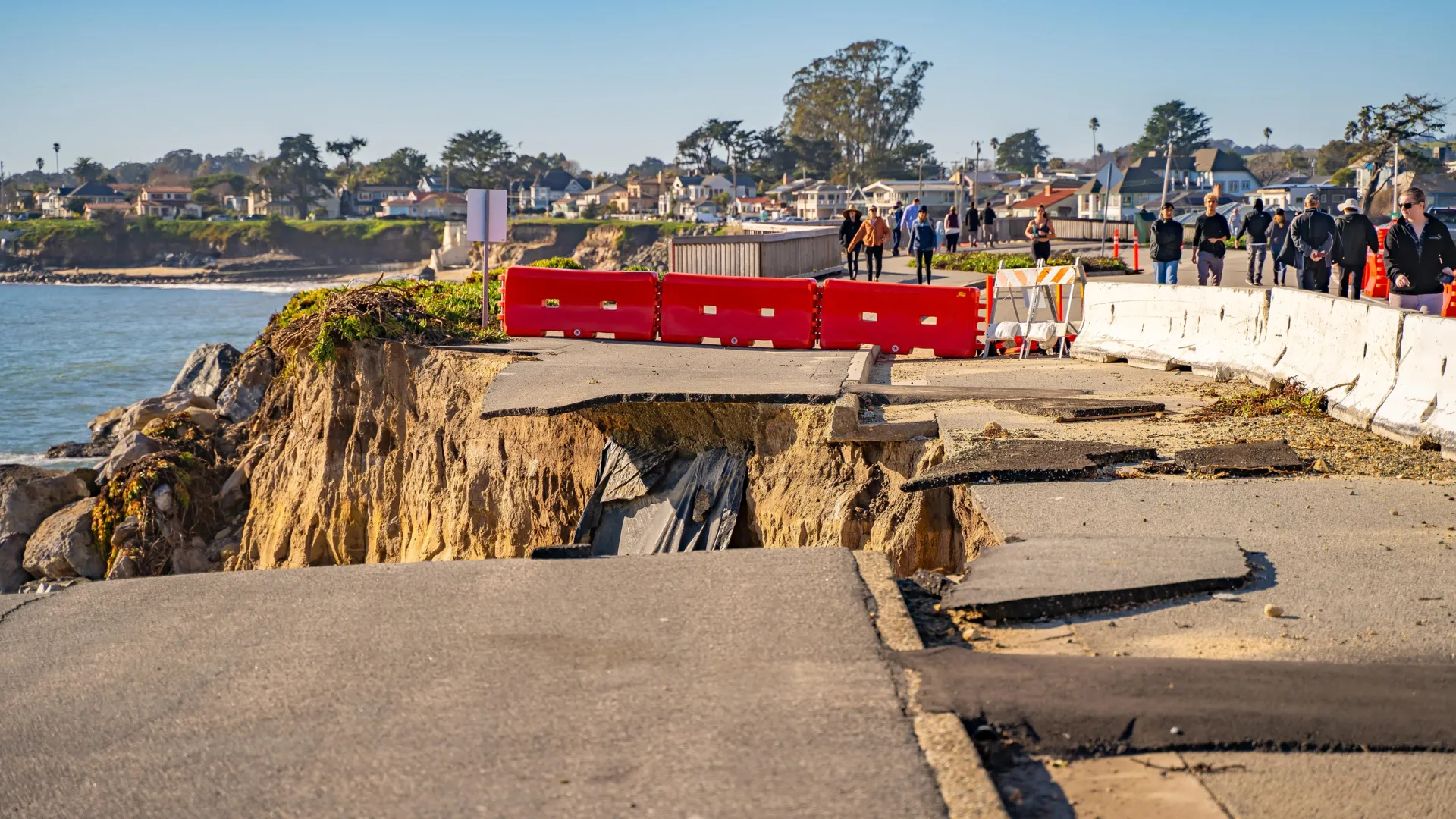
While this configuration might appear straightforward when visualized on a two-dimensional map, geoscientists assert that the subterranean architecture is considerably more convoluted. A stark illustration of this complexity emerged in 1992 with a powerful magnitude 7.2 earthquake that originated at a considerably shallower depth than initial assessments suggested, prompting a re-evaluation of established models.
The challenge of comprehending the Earth’s internal structure is akin to the analogy of studying an iceberg, according to first author David Shelly of the USGS Geologic Hazards Center in Golden, Colorado. "We can observe a portion at the surface, but deducing the precise configuration beneath requires sophisticated investigative methods," Shelly elaborated, underscoring the necessity of looking beyond the visible.
To penetrate this hidden subterranean realm, Shelly and his research cohort deployed an extensive network of highly sensitive seismometers across the Pacific Northwest. These instruments meticulously documented an abundance of exceedingly faint seismic events, often referred to as "low-frequency" earthquakes, which occur in areas where tectonic plates engage in gradual slippage or override one another. These imperceptible tremors are magnitudes weaker than the earthquakes typically felt by humans on the surface, rendering them undetectable without specialized equipment.
The research team rigorously validated their developing subsurface model by analyzing the correlation between these micro-earthquakes and Earth’s tidal forces. Analogous to how the gravitational influence of the Sun and Moon orchestrates ocean tides, these celestial bodies exert subtle yet persistent stresses on the planet’s tectonic plates. When these tidal forces align with the prevailing direction of plate movement, a discernible increase in the frequency of these low-magnitude seismic events has been observed, as explained by Professor Thomas.
The investigators’ detailed analysis revealed that the geological configuration beneath Northern California is not characterized by merely three major tectonic plates, but rather by a dynamic interplay of five distinct moving segments, two of which lie concealed deep beneath the surface.
At the southernmost extent of the Cascadia subduction zone, the research uncovered evidence that a section of the North American plate has fractured and is being drawn downwards, effectively being dragged along with the sinking Gorda plate as it descends into the Earth’s mantle.
Further south of the Mendocino Triple Junction, the Pacific plate is observed to be pulling a significant mass of rock, termed the Pioneer fragment, beneath the North American plate as it continues its northward trajectory. Crucially, the interface separating the Pioneer fragment from the North American plate is oriented nearly horizontally and is not discernible at the ground level. Historical geological evidence suggests that the Pioneer fragment was once an integral part of the ancient Farallon plate, a vast oceanic plate that once bordered the California coastline before its eventual fragmentation and disappearance beneath the continent.
This revised geological framework offers a compelling explanation for the anomalous shallow depth of the 1992 earthquake. According to former lead author of the study, the rate at which the Earth’s surface is being thrust beneath North America is not as profound as scientists had previously hypothesized. "The prevailing assumption was that faults typically follow the leading edge of the subducting slab, but this particular event challenges that notion," commented Materna, a former USGS scientist. "It appears that the plate boundary is situated in a location that deviates from our prior understanding." The research received crucial financial backing through a grant awarded by the National Science Foundation.
About the Author


